Login

Si pozabil/a podatke za prijavo?

Cookies have to be accepted!
Your browser's cookie functionality is disabled. Please enable this functionality.

Not a member yet?

Register now
Login

Available for registred users only

Log in to use this feature.

Si pozabil/a podatke za prijavo?

Cookies have to be accepted!
Your browser's cookie functionality is disabled. Please enable this functionality.

Not a member yet?

Register now
Filter
Kategorije
Advanced filters
  • Dolžina (km)
  • Metri nadmorske višine
Shrani filter Reset filter

TrackRank

QRCode

Technical data

Dolžina12,2 km Metri nadmorske višine417 m Way down417 m Trajanje03:30 h:m Datum05.10.2008
Ocene Author Pokrajina Dejavnik zabave Kondicija Tehnika

Statistika

981 Pogledi Ocene 152 Prenosi Povprečje
Rate
  • List z izleti
  • Prihod
  • Prenosi
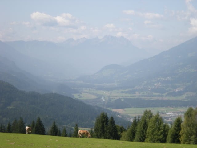
Wanderung über den nördlichen Waldweg zum Gasthof Tschabitscher. Von dort hat man eine wunderbare Aussicht ins Drautal und auf den Reißkofel. Der Rückweg führt am See entlang.

Galerija izletov

Zemljevid in višinski profil izleta

  • Open Street Map
  • Google
Minimum height 927 m Maximum height 1091 m Prikaz podrobnosti

More about the tour author

edgar13
Member since 2008

Send private message

Komentarji

Poti GPS

Trackpoints
  • GPX / Garmin Map Source (gpx) download
  • TCX / Garmin Training Center® (tcx) download
  • CRS / Garmin Training Center® (crs) download
  • Google Earth (kml) download
  • G7ToWin (g7t) download
  • TTQV (trk) download
  • Overlay (ovl) download
  • Fugawi (txt) download
  • Kompass (DAV) Track (tk) download
  • List z izleti (pdf) download
  • Original file of the author (gpx) download

More about the tour author

edgar13
Member since 2008

Send private message
Share track
Add to my favorites
Remove from my favorites
Edit tags
My score
Rate
Izlet: Techendorf - Gasthof Tschabitscher
Vrsta: Pešačenje
Dolžina: 12,2 km
Evaluated on:
Trajanje:
Day(s)
Hour(s)
Minute(s)
Ocena: Pokrajina Dejavnik zabave Kondicija Tehnika