Login

Si pozabil/a podatke za prijavo?

Cookies have to be accepted!
Your browser's cookie functionality is disabled. Please enable this functionality.

Not a member yet?

Register now
Login

Available for registred users only

Log in to use this feature.

Si pozabil/a podatke za prijavo?

Cookies have to be accepted!
Your browser's cookie functionality is disabled. Please enable this functionality.

Not a member yet?

Register now
Filter
Kategorije
Advanced filters
  • Dolžina (km)
  • Metri nadmorske višine
Shrani filter Reset filter

TrackRank

QRCode

Technical data

Dolžina43,3 km Metri nadmorske višine974 m Way down957 m Trajanje03:00 h:m Datum17.11.2008
Ocene Author Pokrajina Dejavnik zabave Kondicija Tehnika

Statistika

520 Pogledi Ocene 87 Prenosi Povprečje
Rate
  • List z izleti
  • Prihod
  • Prenosi

Asphalt - Runde für nasse Tage

Trainingsrunde mit vielen Höhenmetern nähe Leverkusen.

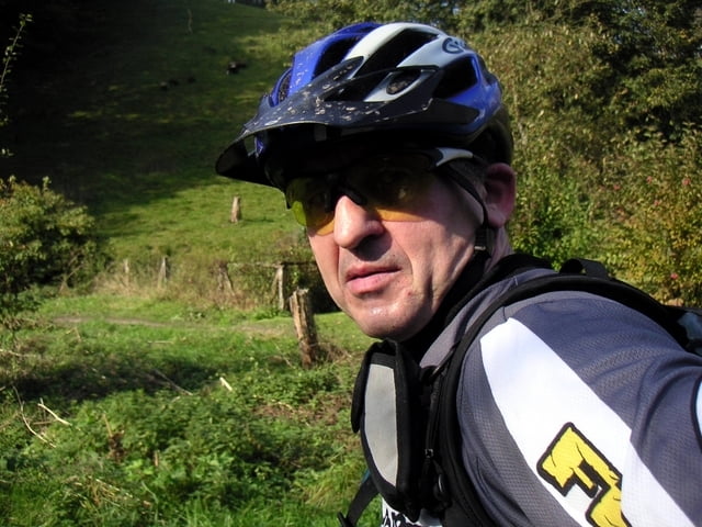
Auf Nebenstraßen führt Tourenguide Carlo (Bild) die Asphalt-Runde. Im ständigen auf und ab so dass am Ende ca. 900 Hm erreicht werden.

Zemljevid in višinski profil izleta

  • Open Street Map
  • Google
Minimum height 1 m Maximum height 190 m Prikaz podrobnosti

More about the tour author

willibike
Member since 2008

Send private message

Komentarji

Poti GPS

Trackpoints
  • GPX / Garmin Map Source (gpx) download
  • TCX / Garmin Training Center® (tcx) download
  • CRS / Garmin Training Center® (crs) download
  • Google Earth (kml) download
  • G7ToWin (g7t) download
  • TTQV (trk) download
  • Overlay (ovl) download
  • Fugawi (txt) download
  • Kompass (DAV) Track (tk) download
  • List z izleti (pdf) download
  • Original file of the author (gpx) download

More about the tour author

willibike
Member since 2008

Send private message
Share track
Add to my favorites
Remove from my favorites
Edit tags
My score
Rate
Izlet: Asphalt Runde für nasse Tage
Vrsta: Gorsko kolo
Dolžina: 43,3 km
Evaluated on:
Trajanje:
Day(s)
Hour(s)
Minute(s)
Ocena: Pokrajina Dejavnik zabave Kondicija Tehnika