Login

Si pozabil/a podatke za prijavo?

Cookies have to be accepted!
Your browser's cookie functionality is disabled. Please enable this functionality.

Not a member yet?

Register now
Login

Available for registred users only

Log in to use this feature.

Si pozabil/a podatke za prijavo?

Cookies have to be accepted!
Your browser's cookie functionality is disabled. Please enable this functionality.

Not a member yet?

Register now
Filter
Kategorije
Advanced filters
  • Dolžina (km)
  • Metri nadmorske višine
Shrani filter Reset filter

TrackRank

QRCode

Technical data

Dolžina30,9 km Metri nadmorske višine1055 m Way down1012 m Trajanje00:00 h:m Datum04.01.2009
Ocene Author Pokrajina Dejavnik zabave Kondicija Tehnika

Statistika

378 Pogledi Ocene 106 Prenosi Povprečje
Rate
  • List z izleti
  • Prihod
  • Prenosi
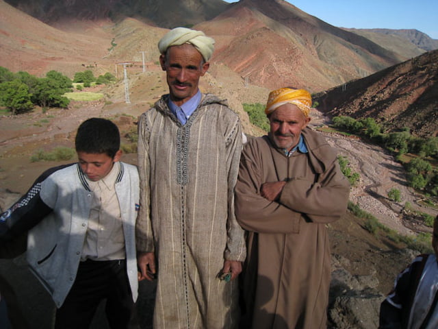
Die Tour ist in einer schönen Landschaft. Weit ab von allen andern Touren die das Land bereisen. Die Leute sind in dem Abschnitt sehr freundlich zu uns gewesen. Der letzte Teil der Tour ist eine Wanderung!!!

Galerija izletov

Zemljevid in višinski profil izleta

  • Open Street Map
  • Google
Minimum height 1809 m Maximum height 2355 m Prikaz podrobnosti

More about the tour author

rheid
Member since 2008

Send private message

Komentarji

Poti GPS

Trackpoints
  • GPX / Garmin Map Source (gpx) download
  • TCX / Garmin Training Center® (tcx) download
  • CRS / Garmin Training Center® (crs) download
  • Google Earth (kml) download
  • G7ToWin (g7t) download
  • TTQV (trk) download
  • Overlay (ovl) download
  • Fugawi (txt) download
  • Kompass (DAV) Track (tk) download
  • List z izleti (pdf) download
  • Original file of the author (gpx) download

More about the tour author

rheid
Member since 2008

Send private message
Share track
Add to my favorites
Remove from my favorites
Edit tags
My score
Rate
Izlet: Bergtour in der Nähe von Aït-Ben-Haddou
Vrsta: Gorsko kolo
Dolžina: 30,9 km
Evaluated on:
Trajanje:
Day(s)
Hour(s)
Minute(s)
Ocena: Pokrajina Dejavnik zabave Kondicija Tehnika