


Die Tour wird im Taschenbuch "Wandern um Jena, Südliche Umgebung", erschienen im Jenzig-Verlag, als Wanderung 5 genau beschrieben.
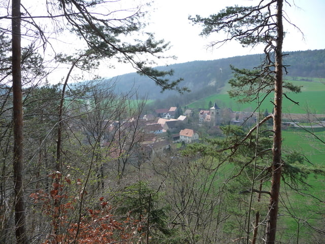
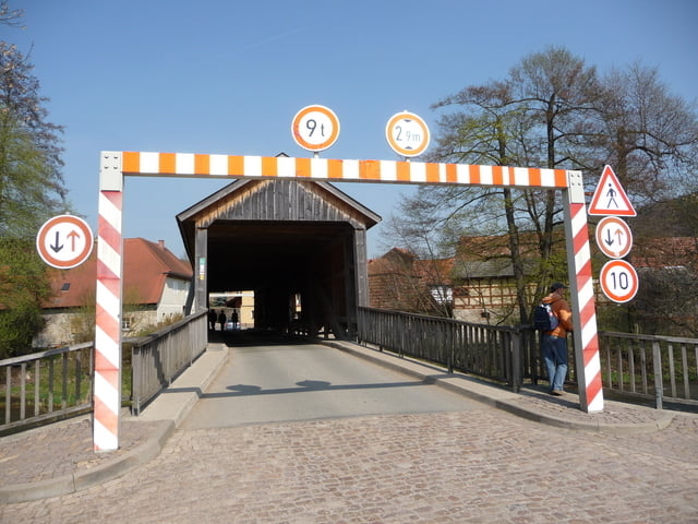
Schöne Buchenwälder, im Frühling mit Waldblumen, der Kötsch, der höchste Berg im Weimarer Land sowie Felsenburg und Hausbrücke in Buchfart bilden Höhepunkte der Wanderung.
Further information at
http://www.openstreetmap.org/?lat=50.9212&lon=11.3318&zoom=13&layers=B000FTFGalerija izletov

Zemljevid in višinski profil izleta
Minimum height 251 m
Maximum height 503 m
More about the tour author
|
|
aussie1248 |
Komentarji

A4 bis Ausfahrt Apolda, auf die B87 Richtung Bad Berka abbiegen, Buchfart ist nach Oettern das zweite Dorf an der B87, Parken im Dorf möglich
Poti GPS
Trackpoints-
GPX / Garmin Map Source (gpx) download
-
TCX / Garmin Training Center® (tcx) download
-
CRS / Garmin Training Center® (crs) download
-
Google Earth (kml) download
-
G7ToWin (g7t) download
-
TTQV (trk) download
-
Overlay (ovl) download
-
Fugawi (txt) download
-
Kompass (DAV) Track (tk) download
-
List z izleti (pdf) download
-
Original file of the author (gpx) download
More about the tour author
|
|
aussie1248 |
Add to my favorites
Remove from my favorites
Edit tags
Open track
My score
Rate