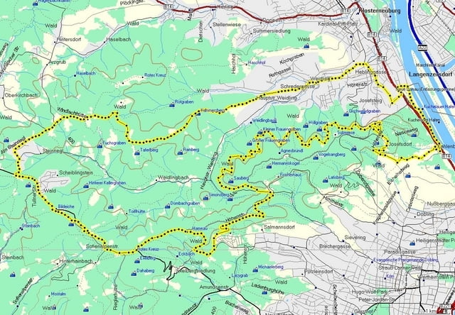
Nette Runde im Wienerwald, nordwestlich von Wien.
Kahlenbergerdorf - Höhenstraße - Sendeanlage Kahlenberg - Hermannskogel - Hameau - Exelberg - Steinriegl - Windischhütte - Weidling.
Diese Tour zeichnet sich durch einen knackigen Uphill zu Beginn, lässige Waldwege und einige schnelle Abfahrten aus. Eine Rast auf der Windischhütte sollte man sich schon gönnen.
Galerija izletov
Zemljevid in višinski profil izleta
Minimum height 99999 m
Maximum height -99999 m
Komentarji

Start und Ziel : Kahlenbergerdorf
Poti GPS
Trackpoints-
GPX / Garmin Map Source (gpx) download
-
TCX / Garmin Training Center® (tcx) download
-
CRS / Garmin Training Center® (crs) download
-
Google Earth (kml) download
-
G7ToWin (g7t) download
-
TTQV (trk) download
-
Overlay (ovl) download
-
Fugawi (txt) download
-
Kompass (DAV) Track (tk) download
-
List z izleti (pdf) download
-
Original file of the author (gpx) download
Add to my favorites
Remove from my favorites
Edit tags
Open track
My score
Rate


