


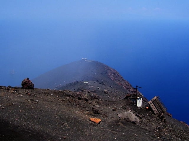
Aufstieg von Stomboli-Ort zum höchsten Punkt am Krater. (Ist nicht der höchste Punkt der Insel)
Von den Schutzständen am Grat lassen sich die Eruptionen - vor allem bei Nacht - gut beobachten.
Technisch unschwierig, mit festen Turnschuhen begehbar, aber die Gefahren des Vulkans beachten: Eruptionen, Schwefelgase, Sturm, Sandsturm, Hitze, Kälte, Verirren im Nebel...
Aufstieg soll ohne Führer angeblich verboten sein.
Unbedingt mitnehmen pro Person:
1l Wasser, (Am besten: Taucher-)Brille gegen Sand, Pullover(auch wenn's unten noch so heiß ist), winddichte Kleidung, Mütze, Handschuhe, Taschenlampe. Man muss unter Umständen mehr als 1 Stunde auf einen Ausbruch warten, dabei wird's im Sturm sehr schnell kalt. Ev. Schlafsack mitbringen! Übernachten ist definitiv verboten.
Galerija izletov


Zemljevid in višinski profil izleta
Minimum height 47 m
Maximum height 923 m
More about the tour author
|
|
hans-lauber |
Komentarji
Von der Kirche geht östlich gleich neben einer Apotheke ein Weg los. Zum Gipfel nicht beschildert.
Poti GPS
Trackpoints-
GPX / Garmin Map Source (gpx) download
-
TCX / Garmin Training Center® (tcx) download
-
CRS / Garmin Training Center® (crs) download
-
Google Earth (kml) download
-
G7ToWin (g7t) download
-
TTQV (trk) download
-
Overlay (ovl) download
-
Fugawi (txt) download
-
Kompass (DAV) Track (tk) download
-
List z izleti (pdf) download
-
Original file of the author (gpx) download
More about the tour author
|
|
hans-lauber |
Add to my favorites
Remove from my favorites
Edit tags
Open track
My score
Rate
Must see