


Eine Lange Tour von Herrenberg-Kayh nach Plochingen und zurück.
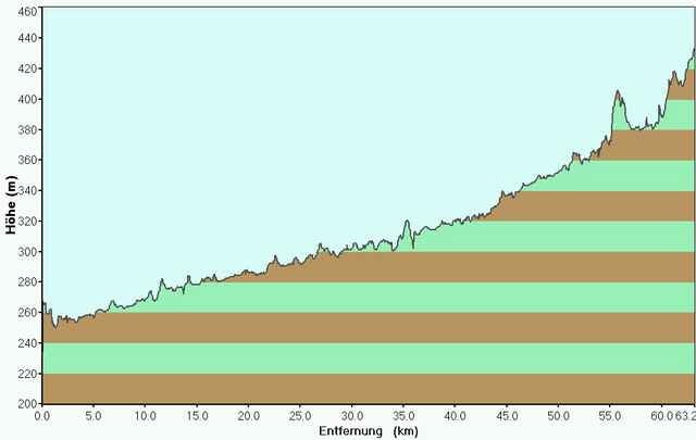
Die Tour führt komplett ein mal herum und könnte somit überall gestartet werden. Ich beginne in Kayh. Von dort geht es erst mal über Mönchberg in den Schönbuch. Hat man den Berg geschafft geht es bis Bebenhausen erst mal hinunter. Dann folgen wir dem Hohenzollern-Radweg wieder hinauf. Das ist die schwerste Etappe bis nach Wolfschlugen. Ab hier geht es bis Plochingen in die Innenstadt nur noch bergab. Die schwerere Hälfte ist geschafft.
Auf dem Rückweg begeben wir uns auf den flachen Neckartal-Radweg. Leichte kontinuierliche Steigungen führen uns bis nach Tübingen. Von hier aus halten wir uns an das Ammertal und radeln über Gültstein bis nach Kayh.
Galerija izletov
Zemljevid in višinski profil izleta
Minimum height 234 m
Maximum height 2147483647 m
More about the tour author

|
Helicon |
Komentarji

Poti GPS
Trackpoints-
GPX / Garmin Map Source (gpx) download
-
TCX / Garmin Training Center® (tcx) download
-
CRS / Garmin Training Center® (crs) download
-
Google Earth (kml) download
-
G7ToWin (g7t) download
-
TTQV (trk) download
-
Overlay (ovl) download
-
Fugawi (txt) download
-
Kompass (DAV) Track (tk) download
-
List z izleti (pdf) download
-
Original file of the author (g7t) download
More about the tour author
|
|
Helicon |
Add to my favorites
Remove from my favorites
Edit tags
Open track
My score
Rate