Login

Si pozabil/a podatke za prijavo?

Cookies have to be accepted!
Your browser's cookie functionality is disabled. Please enable this functionality.

Not a member yet?

Register now
Login

Available for registred users only

Log in to use this feature.

Si pozabil/a podatke za prijavo?

Cookies have to be accepted!
Your browser's cookie functionality is disabled. Please enable this functionality.

Not a member yet?

Register now
Filter
Kategorije
Advanced filters
  • Dolžina (km)
  • Metri nadmorske višine
Shrani filter Reset filter

TrackRank

QRCode

Technical data

Dolžina6,0 km Metri nadmorske višine263 m Way down266 m Trajanje01:30 h:m Datum26.04.2010
Ocene Author Pokrajina Dejavnik zabave Kondicija Tehnika

Statistika

4818 Pogledi Ocene 38 Prenosi Povprečje
Rate
  • List z izleti
  • Prihod
  • Prenosi

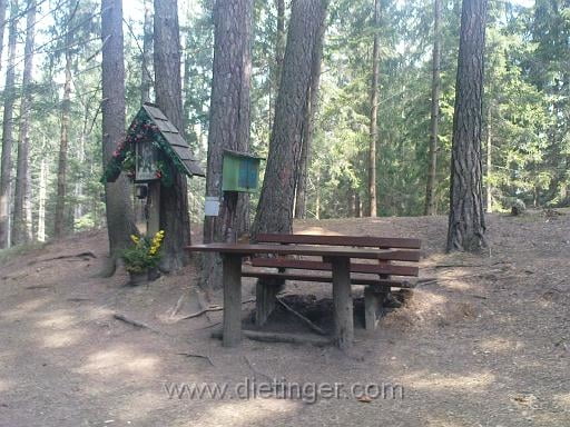
Vom Trabochersee durch den Veitscherwald zum Tannkogel, und von dort über einen schönen wanderweg zum Wolfskreuz. Ein idyllisches Platzerl zum Verweilen.

Galerija izletov

Zemljevid in višinski profil izleta

  • Open Street Map
  • Google
Minimum height 607 m Maximum height 876 m Prikaz podrobnosti

More about the tour author

transalper
Member since 2010

Send private message

Komentarji

Parkplatz Trabochersee

Poti GPS

Trackpoints
  • GPX / Garmin Map Source (gpx) download
  • TCX / Garmin Training Center® (tcx) download
  • CRS / Garmin Training Center® (crs) download
  • Google Earth (kml) download
  • G7ToWin (g7t) download
  • TTQV (trk) download
  • Overlay (ovl) download
  • Fugawi (txt) download
  • Kompass (DAV) Track (tk) download
  • List z izleti (pdf) download
  • Original file of the author (gpx) download

More about the tour author

transalper
Member since 2010

Send private message
Share track
Add to my favorites
Remove from my favorites
Edit tags
My score
Rate
Izlet: Wolfskreuz - Trabochersee
Vrsta: Pešačenje
Dolžina: 6,0 km
Evaluated on:
Trajanje:
Day(s)
Hour(s)
Minute(s)
Ocena: Pokrajina Dejavnik zabave Kondicija Tehnika