Login

Si pozabil/a podatke za prijavo?

Cookies have to be accepted!
Your browser's cookie functionality is disabled. Please enable this functionality.

Not a member yet?

Register now
Login

Available for registred users only

Log in to use this feature.

Si pozabil/a podatke za prijavo?

Cookies have to be accepted!
Your browser's cookie functionality is disabled. Please enable this functionality.

Not a member yet?

Register now
Filter
Kategorije
Advanced filters
  • Dolžina (km)
  • Metri nadmorske višine
Shrani filter Reset filter

TrackRank

QRCode

Technical data

Dolžina2,2 km Metri nadmorske višine41 m Way down10 m Trajanje00:20 h:m Datum13.07.2010
Ocene Author Pokrajina Dejavnik zabave Kondicija Tehnika

Statistika

365 Pogledi Ocene 17 Prenosi Povprečje
Rate
  • List z izleti
  • Prihod
  • Prenosi

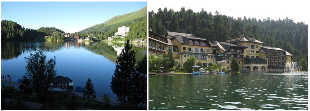
Der Spazier- bzw. Wanderweg führt um den Turracher See herum und hat bis auf eine kleine, sehr kurze Steigung keine Schwierigkeit.

Zemljevid in višinski profil izleta

  • Open Street Map
  • Google
Minimum height 1739 m Maximum height 1795 m Prikaz podrobnosti

More about the tour author

huberj59
Member since 2009

Send private message

Komentarji

Über die B95 auf die Turracher Höhe zum See fahren und unmittelbar beim See einen Parkplatz suchen.

Poti GPS

Trackpoints
  • GPX / Garmin Map Source (gpx) download
  • TCX / Garmin Training Center® (tcx) download
  • CRS / Garmin Training Center® (crs) download
  • Google Earth (kml) download
  • G7ToWin (g7t) download
  • TTQV (trk) download
  • Overlay (ovl) download
  • Fugawi (txt) download
  • Kompass (DAV) Track (tk) download
  • List z izleti (pdf) download
  • Original file of the author (gpx) download

More about the tour author

huberj59
Member since 2009

Send private message
Share track
Add to my favorites
Remove from my favorites
Edit tags
My score
Rate
Izlet: Turracher Höhe - Turracher See Runde
Vrsta: Pešačenje
Dolžina: 2,2 km
Evaluated on:
Trajanje:
Day(s)
Hour(s)
Minute(s)
Ocena: Pokrajina Dejavnik zabave Kondicija Tehnika