
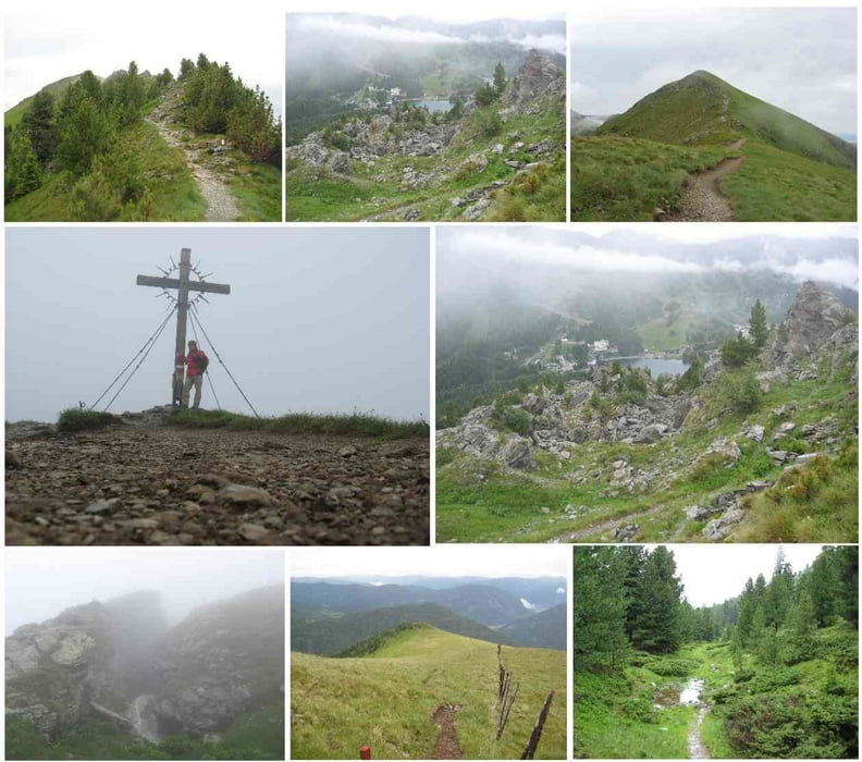

Vom Start am Turracher See gehts hinauf zur Sonnalm und von dort der Forststraße folgend hinauf zu den Bergstationen der Lifte.
Nun beginnt der schöne Wanderweg hinauf zum Sendemasten und weiter über schöne Felsengebilde hin zum Gipfelkreuz.
Etwa 10 Minuten später kommt die Gruft und präsentiert sich mit iher Felsenspalte und dem Schnee gespentisch.
Der Abstieg über den Schönebennock ist einfach und führt anschließend durch den Wald auf einem Forstweg Richtung Katscherhütte.
Von dort zur Mei-Zeit-Siedlung und retour zum Turracher See.
Zemljevid in višinski profil izleta
Minimum height 1785 m
Maximum height 2221 m
More about the tour author
|
|
huberj59 |
Komentarji

B95 bis Turracher Höhe und Parkplatz suchen. Dann weiter Richtung Sonnalm.
Poti GPS
Trackpoints-
GPX / Garmin Map Source (gpx) download
-
TCX / Garmin Training Center® (tcx) download
-
CRS / Garmin Training Center® (crs) download
-
Google Earth (kml) download
-
G7ToWin (g7t) download
-
TTQV (trk) download
-
Overlay (ovl) download
-
Fugawi (txt) download
-
Kompass (DAV) Track (tk) download
-
List z izleti (pdf) download
-
Original file of the author (gpx) download
More about the tour author
|
|
huberj59 |
Add to my favorites
Remove from my favorites
Edit tags
Open track
My score
Rate