


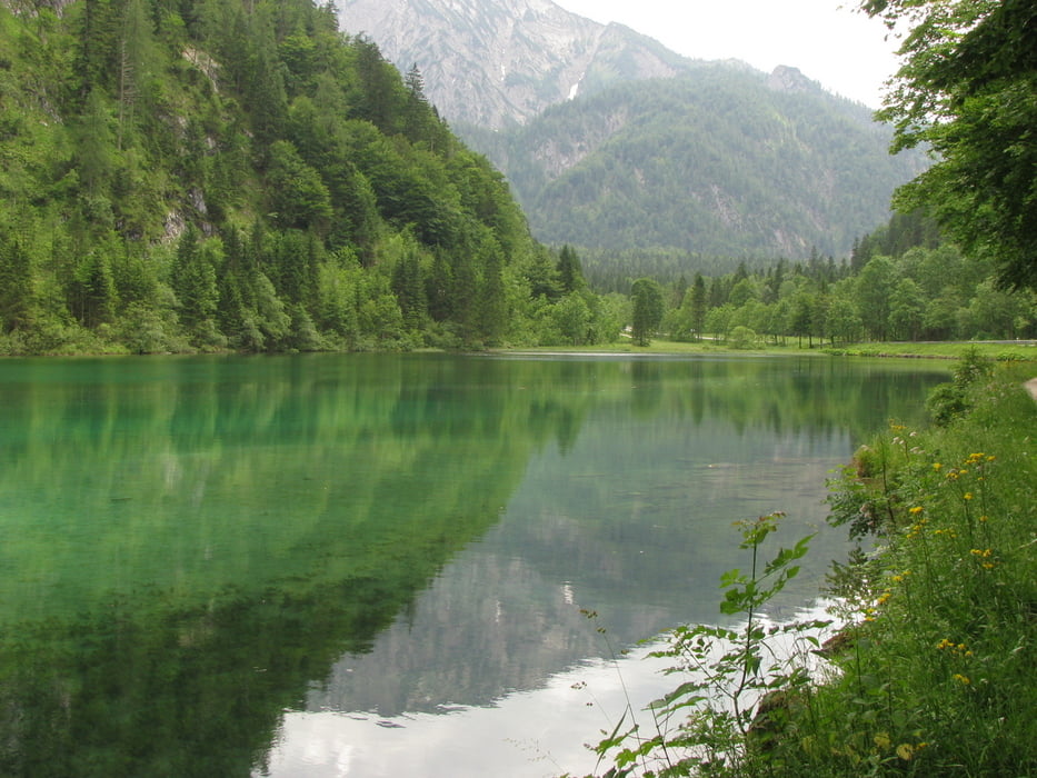
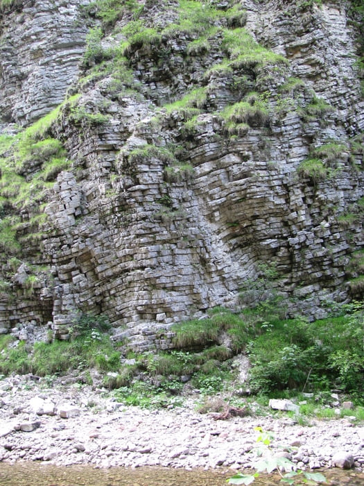
Schöne Rundtour mit abwechslungsreichem Höhenprofil im Berchtesgadener Land und über Ruhpolding zur Winkelmoosalm und über Unken zurück zum Ausgangspunkt mit Einkehrmöglichkeiten. Wer Glück hat, kann am Biathlonstadion in Ruhpolding den Profis beim (Sommer-) Training zusehen. Nach der Auffahrt zur Winkelmossalm gibt es in der Abfahrt noch einen geologisch interessanten und beeindruckenden Canyon zu bestaunen. Entsprechend meinem Höhenmesser hatte die Tour im Gegensatz zu den hier ermittelten über 2000 (!) Höhenmetern gemessene 1250 Höhenmeter, was auch realistischer ist und mehr dem Gefühl in meinen Wadeln am Ende des Tages entsprach.
Galerija izletov
Zemljevid in višinski profil izleta
Minimum height 498 m
Maximum height 1156 m
More about the tour author

|
mauntenbeiker |
Komentarji

Poti GPS
Trackpoints-
GPX / Garmin Map Source (gpx) download
-
TCX / Garmin Training Center® (tcx) download
-
CRS / Garmin Training Center® (crs) download
-
Google Earth (kml) download
-
G7ToWin (g7t) download
-
TTQV (trk) download
-
Overlay (ovl) download
-
Fugawi (txt) download
-
Kompass (DAV) Track (tk) download
-
List z izleti (pdf) download
-
Original file of the author (gpx) download
More about the tour author
|
|
mauntenbeiker |
Add to my favorites
Remove from my favorites
Edit tags
Open track
My score
Rate