Verbessert die Auermühlen Tour für MTBs!!
Werden sie aber noch weiter verbessern!
Werden sie aber noch weiter verbessern!
Further information at
http://www.mtb-news.de/forum/showthread.php?p=3346287#post3346287Zemljevid in višinski profil izleta
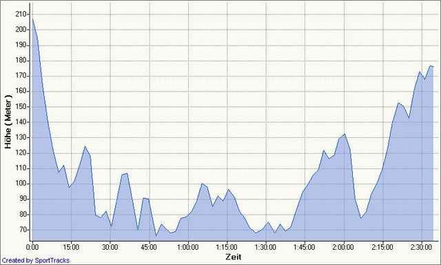
Minimum height 57 m
Maximum height 217 m
Komentarji
Poti GPS
Trackpoints-
GPX / Garmin Map Source (gpx) download
-
TCX / Garmin Training Center® (tcx) download
-
CRS / Garmin Training Center® (crs) download
-
Google Earth (kml) download
-
G7ToWin (g7t) download
-
TTQV (trk) download
-
Overlay (ovl) download
-
Fugawi (txt) download
-
Kompass (DAV) Track (tk) download
-
List z izleti (pdf) download
-
Original file of the author (gpx) download
Add to my favorites
Remove from my favorites
Edit tags
Open track
My score
Rate


Keine Daten
wollte die Strecke mal nachfahren (nachdem Ihr meine schlecht bewertet habt), jedoch kann man sie nicht downloaden.
Vielleicht die Tour nochmal neu reinstellen, entweder wenn man mal krank ist oder auf dem Hollandrad fährt.
Kannste im Moment eh Knicken Dank Kyrill
Tourbewertung