Login

Si pozabil/a podatke za prijavo?

Cookies have to be accepted!
Your browser's cookie functionality is disabled. Please enable this functionality.

Not a member yet?

Register now
Login

Available for registred users only

Log in to use this feature.

Si pozabil/a podatke za prijavo?

Cookies have to be accepted!
Your browser's cookie functionality is disabled. Please enable this functionality.

Not a member yet?

Register now
Filter
Kategorije
Advanced filters
  • Dolžina (km)
  • Metri nadmorske višine
Shrani filter Reset filter

TrackRank

QRCode

Technical data

Dolžina6,7 km Metri nadmorske višine60 m Way down80 m Trajanje01:15 h:m Datum07.08.2010
Ocene Author Pokrajina Dejavnik zabave Kondicija Tehnika

Statistika

199 Pogledi Ocene 36 Prenosi Povprečje
Rate
  • List z izleti
  • Prihod
  • Prenosi

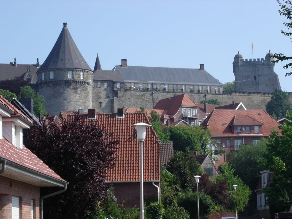
Bei dieser Wanderung geht man auf Forst- und Wanderwegen durch artenreichen Wald sowie durch Wohngebiete von Bad Bentheim. Von der Maate aus hat man einen schönen Blick auf die Südfront der Bentheimer Burg. Diese Wanderung nennt sich Südlicher Rundweg und ist in der Wanderkarte von Bad Bentheim mit einer 4 gekennzeichnet.

Galerija izletov

Zemljevid in višinski profil izleta

  • Open Street Map
  • Google
Minimum height 35 m Maximum height 67 m Prikaz podrobnosti

More about the tour author

rödivomsee
Member since 2008

Send private message

Komentarji

Parkmöglichkeit besteht in der Tiefgarage die sich im Ortskern von Bad Bentheim befindet.

Poti GPS

Trackpoints
  • GPX / Garmin Map Source (gpx) download
  • TCX / Garmin Training Center® (tcx) download
  • CRS / Garmin Training Center® (crs) download
  • Google Earth (kml) download
  • G7ToWin (g7t) download
  • TTQV (trk) download
  • Overlay (ovl) download
  • Fugawi (txt) download
  • Kompass (DAV) Track (tk) download
  • List z izleti (pdf) download
  • Original file of the author (gpx) download

More about the tour author

rödivomsee
Member since 2008

Send private message
Share track
Add to my favorites
Remove from my favorites
Edit tags
My score
Rate
Izlet: Südlicher Rundweg
Vrsta: Pešačenje
Dolžina: 6,7 km
Evaluated on:
Trajanje:
Day(s)
Hour(s)
Minute(s)
Ocena: Pokrajina Dejavnik zabave Kondicija Tehnika