


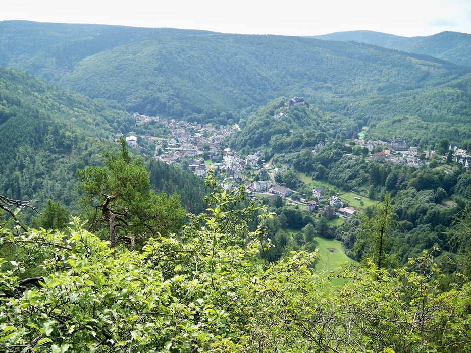
Wanderung von Sitzendorf über den Sommerberg und den Trippstein (herrlicher Ausblick auf Schwarzburg) Richtung Schweizerhaus. Am Schweizerhaus über die Straße und weiter dem Wegweiser "Dürres Schild" folgen. Von dort hat man einen schönen Blick auf das Schweizerhaus. Vom "Dürren Schild" geht es weiter Richtung Schwarzburg. Dem Weg weiter folgen über die Hirschtränke bis zum Abzweig Dittersdorf / Burkersdorf (scharf links). Die Aussicht ins Thüringer Land wird immer besser. Am Ortsausgang Burkersdorf geht es den Betonplattenweg bis zum Abzweig Schabsheider Aussicht. Von dort über die Tanzbuche zum Ausgangspunkt Parkplatz Pocherbrücke.
Einkehrmöglichkeit: Schweizerhaus
Galerija izletov
Zemljevid in višinski profil izleta
Minimum height 263 m
Maximum height 621 m
More about the tour author

|
supersumsi |
Komentarji

Anfahrt über Bad Blankenburg Richtung Sitzendorf. Etwa 500m vor Sitzendorf befindet sich links der Wanderparkplatz an der Pocherbrücke.
Poti GPS
Trackpoints-
GPX / Garmin Map Source (gpx) download
-
TCX / Garmin Training Center® (tcx) download
-
CRS / Garmin Training Center® (crs) download
-
Google Earth (kml) download
-
G7ToWin (g7t) download
-
TTQV (trk) download
-
Overlay (ovl) download
-
Fugawi (txt) download
-
Kompass (DAV) Track (tk) download
-
List z izleti (pdf) download
-
Original file of the author (gpx) download
More about the tour author
|
|
supersumsi |
Add to my favorites
Remove from my favorites
Edit tags
Open track
My score
Rate