Login

Si pozabil/a podatke za prijavo?

Cookies have to be accepted!
Your browser's cookie functionality is disabled. Please enable this functionality.

Not a member yet?

Register now
Login

Available for registred users only

Log in to use this feature.

Si pozabil/a podatke za prijavo?

Cookies have to be accepted!
Your browser's cookie functionality is disabled. Please enable this functionality.

Not a member yet?

Register now
Filter
Kategorije
Advanced filters
  • Dolžina (km)
  • Metri nadmorske višine
Shrani filter Reset filter

TrackRank

QRCode

Technical data

Dolžina67,1 km Metri nadmorske višine141 m Way down123 m Trajanje03:30 h:m Datum15.08.2010
Ocene Author User Pokrajina Dejavnik zabave Kondicija Tehnika

Statistika

2278 Pogledi 2 Ocene 161 Prenosi 2.50 Povprečje
Rate
  • List z izleti
  • Prihod
  • Prenosi

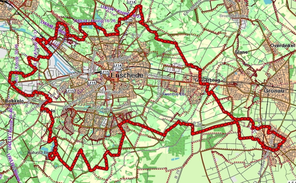
Wir fahren von Epe nach Gronau zum Amtsvennweg. Am Gasthof Gleis fahren wir auf die ausgeschilderte MTB Strecke die komplett um Enschede führt. Nach ca 55 km sind wir wieder am Amtsvennweg in Gronau.

Zemljevid in višinski profil izleta

  • Open Street Map
  • Google
Minimum height 22 m Maximum height 65 m Prikaz podrobnosti

More about the tour author

andyderbiker
Member since 2009

Send private message

Komentarji

Poti GPS

Trackpoints
  • GPX / Garmin Map Source (gpx) download
  • TCX / Garmin Training Center® (tcx) download
  • CRS / Garmin Training Center® (crs) download
  • Google Earth (kml) download
  • G7ToWin (g7t) download
  • TTQV (trk) download
  • Overlay (ovl) download
  • Fugawi (txt) download
  • Kompass (DAV) Track (tk) download
  • List z izleti (pdf) download
  • Original file of the author (gpx) download

More about the tour author

andyderbiker
Member since 2009

Send private message
Share track
Add to my favorites
Remove from my favorites
Edit tags
My score
Rate
Izlet: Die MTB Strecke um Enschede
Vrsta: Gorsko kolo
Dolžina: 67,1 km
Evaluated on:
Trajanje:
Day(s)
Hour(s)
Minute(s)
Ocena: Pokrajina Dejavnik zabave Kondicija Tehnika