Login

Si pozabil/a podatke za prijavo?

Cookies have to be accepted!
Your browser's cookie functionality is disabled. Please enable this functionality.

Not a member yet?

Register now
Login

Available for registred users only

Log in to use this feature.

Si pozabil/a podatke za prijavo?

Cookies have to be accepted!
Your browser's cookie functionality is disabled. Please enable this functionality.

Not a member yet?

Register now
Filter
Kategorije
Advanced filters
  • Dolžina (km)
  • Metri nadmorske višine
Shrani filter Reset filter

TrackRank

QRCode

Technical data

Dolžina7,7 km Metri nadmorske višine53 m Way down69 m Trajanje02:00 h:m Datum17.10.2010
Ocene Author Pokrajina Dejavnik zabave Kondicija Tehnika

Statistika

755 Pogledi Ocene 230 Prenosi Povprečje
Rate
  • List z izleti
  • Prihod
  • Prenosi

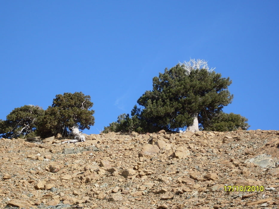
Rundweg um den Gipfel des höchsten Berges von Zypern, den Olympos in 1850 m Höhe. Sehr bequem, mit gutem Schuhwerk zu begehen. Rundum herrliche Panoramaausblicke. Sehr gut markiert. Weg führt durch jahrhundertealten Schwarzkieferbestand.

Galerija izletov

Zemljevid in višinski profil izleta

  • Open Street Map
  • Google
Minimum height 1815 m Maximum height 1856 m Prikaz podrobnosti

More about the tour author

Keschtewaeldele
Member since 2008

Send private message

Komentarji

Startpunkt und Parken: 300 m von der Kreuzung der Straße zum Gipfel des Olympos und der Hauptstraße Troodos-Prodromos 

Poti GPS

Trackpoints
  • GPX / Garmin Map Source (gpx) download
  • TCX / Garmin Training Center® (tcx) download
  • CRS / Garmin Training Center® (crs) download
  • Google Earth (kml) download
  • G7ToWin (g7t) download
  • TTQV (trk) download
  • Overlay (ovl) download
  • Fugawi (txt) download
  • Kompass (DAV) Track (tk) download
  • List z izleti (pdf) download
  • Original file of the author (gpx) download

More about the tour author

Keschtewaeldele
Member since 2008

Send private message
Share track
Add to my favorites
Remove from my favorites
Edit tags
My score
Rate
Izlet: Artemis - Rundweg
Vrsta: Pešačenje
Dolžina: 7,7 km
Evaluated on:
Trajanje:
Day(s)
Hour(s)
Minute(s)
Ocena: Pokrajina Dejavnik zabave Kondicija Tehnika