


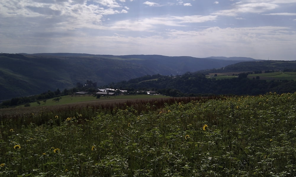
diese Tour ist Höllig. Schöne lange Abfahrten am Aldegundismarkt vorbei rechts ab schlingern durch den Wald an den Damscheider Forsthäusern vorbei.
Bevor es runter durch die Weinberge nach Engehöll geht, ist plötzlich der Rhein und die Schönburg zu sehen. Diese Aussicht sollte man geniesen. Im Tal angekommen geht es links steil bergauf durch den Wald in die Weinberge nach Boppard-Weiler und weitere steile Waldwege führen hinauf auf die Hunsrückhöhen. Vor Perscheid kommt man auf der Höhe an. Durch die Struth>Liebshausen>Steinbach>Horn zurück nach Laubach. Viel Spaß auf der Tour hatten wir. Ist einfach schön diese Ausblicke in den Taunus über die Rheindörfer und Rheintal hinweg.
Further information at
http://www.fahrrad-binz.de/Galerija izletov

Zemljevid in višinski profil izleta
Minimum height 150 m
Maximum height 557 m
More about the tour author
|
|
Dakota_20 |
Komentarji

Poti GPS
Trackpoints-
GPX / Garmin Map Source (gpx) download
-
TCX / Garmin Training Center® (tcx) download
-
CRS / Garmin Training Center® (crs) download
-
Google Earth (kml) download
-
G7ToWin (g7t) download
-
TTQV (trk) download
-
Overlay (ovl) download
-
Fugawi (txt) download
-
Kompass (DAV) Track (tk) download
-
List z izleti (pdf) download
-
Original file of the author (gpx) download
More about the tour author
|
|
Dakota_20 |
Add to my favorites
Remove from my favorites
Edit tags
Open track
My score
Rate