Login

Si pozabil/a podatke za prijavo?

Cookies have to be accepted!
Your browser's cookie functionality is disabled. Please enable this functionality.

Not a member yet?

Register now
Login

Available for registred users only

Log in to use this feature.

Si pozabil/a podatke za prijavo?

Cookies have to be accepted!
Your browser's cookie functionality is disabled. Please enable this functionality.

Not a member yet?

Register now
Filter
Kategorije
Advanced filters
  • Dolžina (km)
  • Metri nadmorske višine
Shrani filter Reset filter

TrackRank

QRCode

Technical data

Dolžina11,2 km Metri nadmorske višine45 m Way down42 m Trajanje02:30 h:m Datum10.04.2011
Ocene Author Pokrajina Dejavnik zabave Kondicija Tehnika

Statistika

211 Pogledi Ocene 16 Prenosi Povprečje
Rate
  • List z izleti
  • Prihod
  • Prenosi

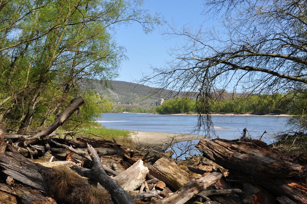
Nach einer eher unspektakulären Wanderung zur Donau erwartet einen dort eine Urlandschaft, mit zahlreichen wildromantischen Pausenplätzen.

Leider konnten wir die geplante Runde nicht erwandern, da sich der Treppelweg, im wahrsten Sinne des Wortes, im Sand verliert.


Alle Fotos siehe LINK

Further information at

https://skydrive.live.com/#cid=DFF63CE9C39979FE&id=DFF63CE9C39979FE%212658

Galerija izletov

Zemljevid in višinski profil izleta

  • Open Street Map
  • Google
Minimum height 139 m Maximum height 152 m Prikaz podrobnosti

More about the tour author

Herbiy
Member since 2009

Send private message

Komentarji

Nationalpark_Donau_A on 12.06.2023

Kein freigegebener Weg

Fehlinfo! Dieser Bereich stellt keinen erlaubten Wanderweg im Nationalpark Donau-Auen dar und soll nicht, wie hier beschrieben, betreten werden. Infos zum erlaubten Wegenetz unter www.donauauen.at/besuchen/erleben/wanderrouten.

Poti GPS

Trackpoints
  • GPX / Garmin Map Source (gpx) download
  • TCX / Garmin Training Center® (tcx) download
  • CRS / Garmin Training Center® (crs) download
  • Google Earth (kml) download
  • G7ToWin (g7t) download
  • TTQV (trk) download
  • Overlay (ovl) download
  • Fugawi (txt) download
  • Kompass (DAV) Track (tk) download
  • List z izleti (pdf) download
  • Original file of the author (gpx) download

More about the tour author

Herbiy
Member since 2009

Send private message
Share track
Add to my favorites
Remove from my favorites
Edit tags
My score
Rate
Izlet: Nationalpark Donauauen / Große Au
Vrsta: Pešačenje
Dolžina: 11,2 km
Evaluated on:
Trajanje:
Day(s)
Hour(s)
Minute(s)
Ocena: Pokrajina Dejavnik zabave Kondicija Tehnika