Login

Si pozabil/a podatke za prijavo?

Cookies have to be accepted!
Your browser's cookie functionality is disabled. Please enable this functionality.

Not a member yet?

Register now
Login

Available for registred users only

Log in to use this feature.

Si pozabil/a podatke za prijavo?

Cookies have to be accepted!
Your browser's cookie functionality is disabled. Please enable this functionality.

Not a member yet?

Register now
Filter
Kategorije
Advanced filters
  • Dolžina (km)
  • Metri nadmorske višine
Shrani filter Reset filter

TrackRank

QRCode

Technical data

Dolžina26,1 km Metri nadmorske višine697 m Way down458 m Trajanje01:30 h:m Datum08.05.2011
Ocene Author Pokrajina Dejavnik zabave Kondicija Tehnika

Statistika

917 Pogledi Ocene 60 Prenosi Povprečje
Rate
  • List z izleti
  • Prihod
  • Prenosi
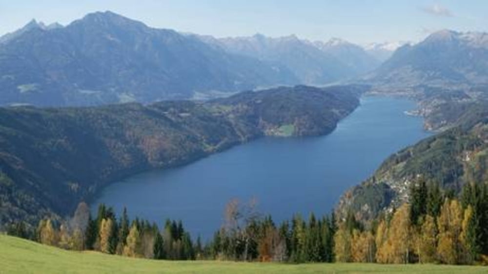
Start in Döbriach entlang des Radweges Millstättersee Südufer, in Seeboden Richtung Liesertal, bei Lieserbrück links auf die "alte Römerstraße" nach Trebesing, Super Wetter. Südufer Millstättersee sehr schön !!!

Zemljevid in višinski profil izleta

  • Open Street Map
  • Google
Minimum height 589 m Maximum height 842 m Prikaz podrobnosti

More about the tour author

kateem
Member since 2010

Send private message

Komentarji

Poti GPS

Trackpoints
  • GPX / Garmin Map Source (gpx) download
  • TCX / Garmin Training Center® (tcx) download
  • CRS / Garmin Training Center® (crs) download
  • Google Earth (kml) download
  • G7ToWin (g7t) download
  • TTQV (trk) download
  • Overlay (ovl) download
  • Fugawi (txt) download
  • Kompass (DAV) Track (tk) download
  • List z izleti (pdf) download
  • Original file of the author (tcx) download

More about the tour author

kateem
Member since 2010

Send private message
Share track
Add to my favorites
Remove from my favorites
Edit tags
My score
Rate
Izlet: Döbriach - Trebesing
Vrsta: Gorsko kolo
Dolžina: 26,1 km
Evaluated on:
Trajanje:
Day(s)
Hour(s)
Minute(s)
Ocena: Pokrajina Dejavnik zabave Kondicija Tehnika