Login

Si pozabil/a podatke za prijavo?

Cookies have to be accepted!
Your browser's cookie functionality is disabled. Please enable this functionality.

Not a member yet?

Register now
Login

Available for registred users only

Log in to use this feature.

Si pozabil/a podatke za prijavo?

Cookies have to be accepted!
Your browser's cookie functionality is disabled. Please enable this functionality.

Not a member yet?

Register now
Filter
Kategorije
Advanced filters
  • Dolžina (km)
  • Metri nadmorske višine
Shrani filter Reset filter

TrackRank

QRCode

Technical data

Dolžina16,3 km Metri nadmorske višine1329 m Way down1305 m Trajanje00:00 h:m Datum19.06.2011
Ocene Author User Pokrajina Dejavnik zabave Kondicija Tehnika

Statistika

1362 Pogledi 1 Ocena 71 Prenosi 3.00 Povprečje
Rate
  • List z izleti
  • Prihod
  • Prenosi

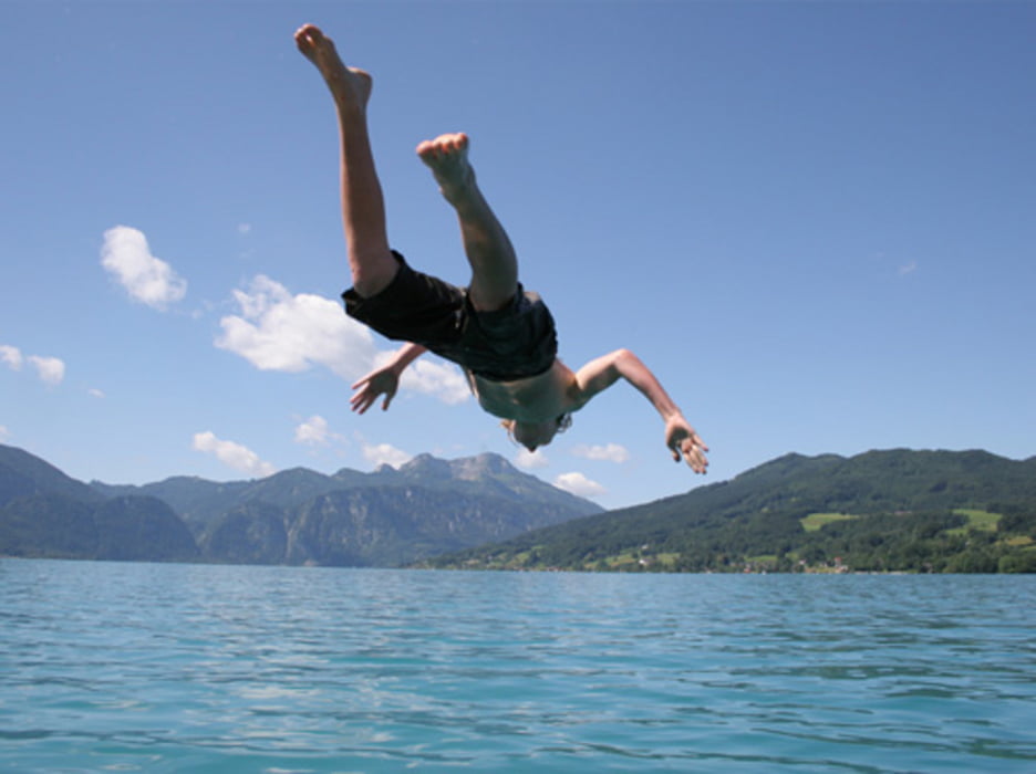
Start ist der Parkplatz in Unterach.


Nach der Tour kann man noch am öffentlichen Badeplatz in den

Attersee springen.

Einkehr auf der Schafbergspitze oder besser auf der

Eisenaueralm.


Aufstieg: 2,5 Std:

Abstieg: 2 Std.

Zemljevid in višinski profil izleta

  • Open Street Map
  • Google
Minimum height 469 m Maximum height 1773 m Prikaz podrobnosti

More about the tour author

thomas_504
Member since 2009

Send private message

Komentarji

Poti GPS

Trackpoints
  • GPX / Garmin Map Source (gpx) download
  • TCX / Garmin Training Center® (tcx) download
  • CRS / Garmin Training Center® (crs) download
  • Google Earth (kml) download
  • G7ToWin (g7t) download
  • TTQV (trk) download
  • Overlay (ovl) download
  • Fugawi (txt) download
  • Kompass (DAV) Track (tk) download
  • List z izleti (pdf) download
  • Original file of the author (gpx) download

More about the tour author

thomas_504
Member since 2009

Send private message
Share track
Add to my favorites
Remove from my favorites
Edit tags
My score
Rate
Izlet: Von Unterach auf den Schafberg
Vrsta: Izlet v gore
Dolžina: 16,3 km
Evaluated on:
Trajanje:
Day(s)
Hour(s)
Minute(s)
Ocena: Pokrajina Dejavnik zabave Kondicija Tehnika