


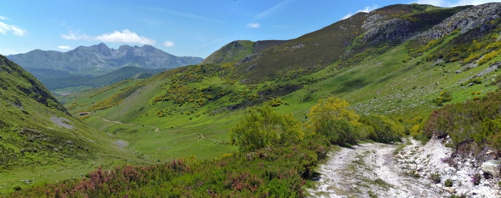
Itinerario en bicicleta de montaña con alforjas desde Ponferrada hasta Espinosa de los Monteros, que recorre la Cordillera Cantábrica pasando por muchos de sus macizos montañosos más representativos. Sigue la ruta descrita por Juanjo Alonso en la guía Transcantábrica en BTT editada por la Editorial Desnivel, coincidiendo en gran parte con el recorrido ciclomontañero.
Fecha: 11 al 22 de Junio de 2011.
Duración: 12 días.
Viajeros: En solitario.
Distancia total: 621 kilómetros.
Media diaria: 53 Km, 1.688 metros de desnivel y 6:02 horas de pedaleo.
Etapas:
01. Ponferrada-Balouta.
Dist.: 64,05 Km.; Asc.: 1.666 m.; IBP.: 123BC.
02. Balouta-Cerredo.
Dist.: 48,36 Km.; Asc.: 1.561 m.; IBP.: 125BA.
03. Cerredo-Genestoso.
Dist.: 32,85 Km.; Asc.: 1.235 m.; IBP.: 100BA.
04. Genestoso-Valle de Lago.
Dist.: 32,66 Km.; Asc.: 1.578 m.; IBP.: 183CB.
05. Valle de Lago-San Emiliano.
Dist.: 42,24 Km.; Asc.: 1.229 m.; IBP.: 125BB.
06. San Emiliano- Busdongo de Arbás.
Dist.: 39,29 Km.; Asc.: 1.529 m.; IBP.: 143BA.
07. Busdongo de Arbás-Puebla de Lillo.
Dist.: 84,15 Km.; Asc.: 2.699 m.; IBP.: 227BB.
08. Puebla de Lillo-Oseja de Sajambre.
Dist.: 42,76 Km.; Asc.: 1.310 m.; IBP.: 130AA.
09. Oseja de Sajambre-Espinama.
Dist.: 44,45 Km.; Asc.: 1.688 m.; IBP.: 140BA.
10. Espinama-San Salvador de Cantamuda.
Dist.: 59,99 Km.; Asc.: 2.374 m.; IBP.: 233CB.
11. San Salvador de Cantamuda-Reinosa.
Dist.: 65,41 Km.; Asc.: 1.605 m.; IBP.: 142AB.
12. Reinosa-Espinosa de los Monteros.
Dist.: 79,55 Km.; Asc.: 1.490 m.; IBP.: 148AB.
Más información: zinaztli.blogspot.com/2011/06/transcantabrica-en-btt-ficha-del-viaje.html
Galerija izletov


Zemljevid in višinski profil izleta
Minimum height 524 m
Maximum height 1867 m
More about the tour author
|
|
zinaztli |
Komentarji

Poti GPS
Trackpoints-
GPX / Garmin Map Source (gpx) download
-
TCX / Garmin Training Center® (tcx) download
-
CRS / Garmin Training Center® (crs) download
-
Google Earth (kml) download
-
G7ToWin (g7t) download
-
TTQV (trk) download
-
Overlay (ovl) download
-
Fugawi (txt) download
-
Kompass (DAV) Track (tk) download
-
List z izleti (pdf) download
-
Original file of the author (gpx) download
More about the tour author
|
|
zinaztli |
Add to my favorites
Remove from my favorites
Edit tags
Open track
My score
Rate