

Wie alle meine Touren, Asphaltvermeidung wo's nur geht
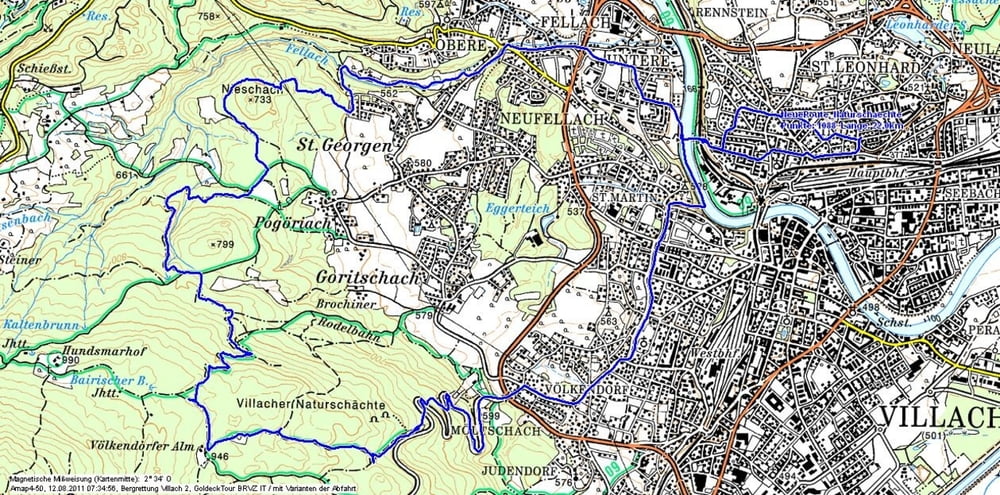
Die Tour führt über Fellach nach St. Georgen, weiter über Steige zum Nieschach und weiter zum "Normalweg" zum Hundsmarhof. Auf dem bleiben wir ca. 60m...:-)
Über den Verbindungsweg zur alten Rodlbahn und hinauf zur Völkendorfer Alm. Von dort über Forststraßen ambitioniert hinunter zum Parkplatz 1.
Die Steige führen uns immer weiter hinunter in Richtung Sprungschanze.
Eine aufwärtsorientierte, recht ambitionierte Tour, die manchmal ein gewissen Gefühl für Steigung braucht, und nicht immer das leichteste Terrain bietet. Aber man kommt in Gebiete, wo einfach keiner ist...
Viel Spass dabei
Further information at
/sl/tracks/detail.78811.htmlZemljevid in višinski profil izleta
Minimum height 505 m
Maximum height 957 m
More about the tour author
|
|
johnatan |
Komentarji

Treffner Straße, Villach Lind
Poti GPS
Trackpoints-
GPX / Garmin Map Source (gpx) download
-
TCX / Garmin Training Center® (tcx) download
-
CRS / Garmin Training Center® (crs) download
-
Google Earth (kml) download
-
G7ToWin (g7t) download
-
TTQV (trk) download
-
Overlay (ovl) download
-
Fugawi (txt) download
-
Kompass (DAV) Track (tk) download
-
List z izleti (pdf) download
-
Original file of the author (gpx) download
More about the tour author
|
|
johnatan |
Add to my favorites
Remove from my favorites
Edit tags
Open track
My score
Rate