Login

Si pozabil/a podatke za prijavo?

Cookies have to be accepted!
Your browser's cookie functionality is disabled. Please enable this functionality.

Not a member yet?

Register now
Login

Available for registred users only

Log in to use this feature.

Si pozabil/a podatke za prijavo?

Cookies have to be accepted!
Your browser's cookie functionality is disabled. Please enable this functionality.

Not a member yet?

Register now
Filter
Kategorije
Advanced filters
  • Dolžina (km)
  • Metri nadmorske višine
Shrani filter Reset filter

TrackRank

QRCode

Technical data

Dolžina39,2 km Metri nadmorske višine1722 m Way down1475 m Trajanje05:00 h:m Datum07.08.2011
Ocene Author Pokrajina Dejavnik zabave Kondicija Tehnika

Statistika

283 Pogledi Ocene 53 Prenosi Povprečje
Rate
  • List z izleti
  • Prihod
  • Prenosi

Von Oberems ca. 8km nach Gruben auf Asphaltstraße. 

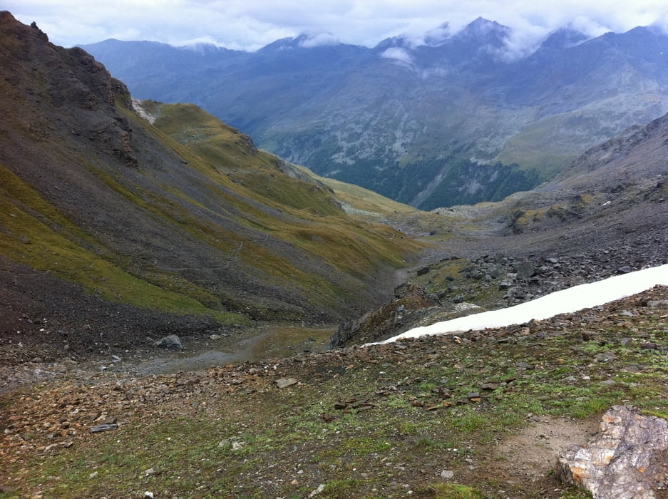
Danach auf Waldwegen in Serpentienen bis auf ca.2.450m auf die Alp Chalte. Von dort bis zum Forclettapass auf 2.874m Schiebe/-Trage Strecke.

Abfahrt zum Teil fahrbar zum Schluss Trail.

Galerija izletov

Zemljevid in višinski profil izleta

  • Open Street Map
  • Google
Minimum height 1296 m Maximum height 2873 m Prikaz podrobnosti

More about the tour author

deckermp
Member since 2010

Send private message

Komentarji

Poti GPS

Trackpoints
  • GPX / Garmin Map Source (gpx) download
  • TCX / Garmin Training Center® (tcx) download
  • CRS / Garmin Training Center® (crs) download
  • Google Earth (kml) download
  • G7ToWin (g7t) download
  • TTQV (trk) download
  • Overlay (ovl) download
  • Fugawi (txt) download
  • Kompass (DAV) Track (tk) download
  • List z izleti (pdf) download
  • Original file of the author (gpx) download

More about the tour author

deckermp
Member since 2010

Send private message
Share track
Add to my favorites
Remove from my favorites
Edit tags
My score
Rate
Izlet: TransAlp11 Etappe 5
Vrsta: Gorsko kolo
Dolžina: 39,2 km
Evaluated on:
Trajanje:
Day(s)
Hour(s)
Minute(s)
Ocena: Pokrajina Dejavnik zabave Kondicija Tehnika