


Beginn:
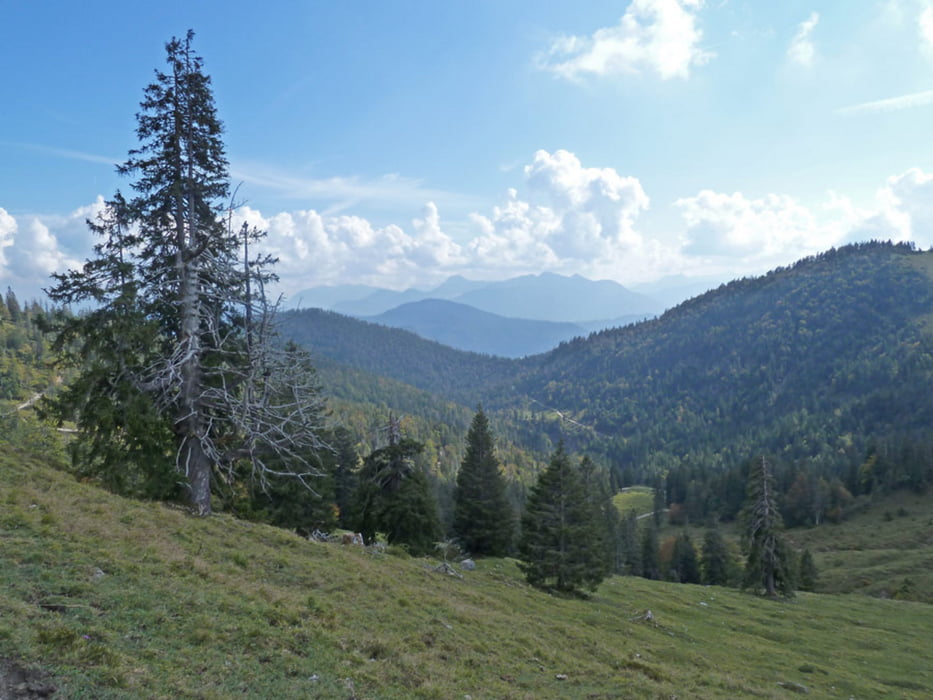
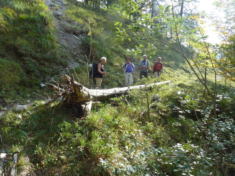
Wanderparkplatz bei Petern (727 mtr) in der Jachenau. Ab 5 Minuten der Beschilderung Benediktenwand folgen und immer bergauf über alten Karrenweg durch den Wald empor. Immer auf dem Hauptweg zur Bichler Alm. Dort wird eine Rast oberhalb der Alm am Wegekreuz mit wunderschönem Ausblick empfohlen. Nun links ab den Panoramaweg nach Jachenau Dorf folgen. Rechts Blick zur Benediktenwand, links in die Ferne und ins Tal, sowie zu anderen Gipfeln. Man geht oberhalb mit Blick zur Tannernalm weiter. Ein kurzes Stück geht es später entlang einer gekiesten breiten Forststraße. Danach wieder steil abwärts nach links einen Wanderweg "steiler Steig" folgend hinunter nach Jachenau Dorf, später am Glasbach entlang zum Schluss als Höhepunkt der Tageswanderung mit mehrfachen Blicken nach oben und von unten zu den Wasserfällen.
Ende: Die Tour endet am Parkplatz Jachenau Dorf (780 mtr.)
Von dort fahren Busse (6 km) bis zum Ausgangspunkt der Haltestelle Peters.
FB_Addon_TelNo{
height:15px !important;
white-space: nowrap !important;
background-color: #0ff0ff;}
FB_Addon_TelNo{ height:15px !important; white-space: nowrap !important; background-color: #0ff0ff;}
FB_Addon_TelNo{ height:15px !important; white-space: nowrap !important; background-color: #0ff0ff;}
FB_Addon_TelNo{ height:15px !important; white-space: nowrap !important; background-color: #0ff0ff;}
FB_Addon_TelNo{ height:15px !important; white-space: nowrap !important; background-color: #0ff0ff;}
FB_Addon_TelNo{ height:15px !important; white-space: nowrap !important; background-color: #0ff0ff;}
Galerija izletov

Zemljevid in višinski profil izleta
Minimum height 704 m
Maximum height 1434 m
More about the tour author
|
|
aemuench |
Komentarji

Mit dem Auto oder Bus von Bad Tölz aus Richtung Jachanau fahren und am Ort Peters, ca. 2 km vor Tannern, an der Bushaltestelle rechts ab zum Wanderparkplatz.
FB_Addon_TelNo{ height:15px !important; white-space: nowrap !important; background-color: #0ff0ff;}
FB_Addon_TelNo{ height:15px !important; white-space: nowrap !important; background-color: #0ff0ff;}
FB_Addon_TelNo{ height:15px !important; white-space: nowrap !important; background-color: #0ff0ff;}
FB_Addon_TelNo{ height:15px !important; white-space: nowrap !important; background-color: #0ff0ff;}
FB_Addon_TelNo{ height:15px !important; white-space: nowrap !important; background-color: #0ff0ff;}
Poti GPS
Trackpoints-
GPX / Garmin Map Source (gpx) download
-
TCX / Garmin Training Center® (tcx) download
-
CRS / Garmin Training Center® (crs) download
-
Google Earth (kml) download
-
G7ToWin (g7t) download
-
TTQV (trk) download
-
Overlay (ovl) download
-
Fugawi (txt) download
-
Kompass (DAV) Track (tk) download
-
List z izleti (pdf) download
-
Original file of the author (gpx) download
More about the tour author
|
|
aemuench |
Add to my favorites
Remove from my favorites
Edit tags
Open track
My score
Rate