
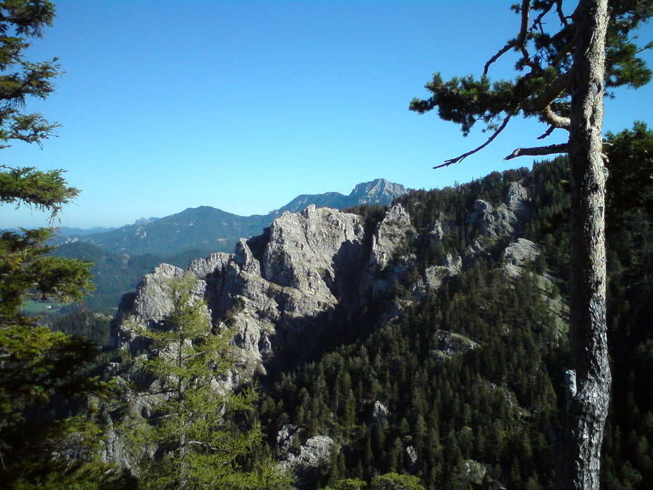

Ab dem Hauptplatz von St. Aegyd den Traisentalradweg bis Kernhof und weiter nach Gscheid folgen. Nach dem Anstieg aufs Gscheid links auf die Forststrasse abbiegen. Am Ende der Stichstrecke herrlicher Ausblick auf die Feuersteinmauer und dahinter den Gippel. Wieder retour zur Abzweigung und nach den letzten Höhenmetern geht es wieder abwärts in Richtung Gscheid. Anschliessend etwas technisch anspruchsvolle Abfahrt über das hintere Gscheid und entlang der Unrechttraisen zurück nach St.Aegyd.
Abfahrt übers hintere Gscheid wurde durch neue Forststrasse im oberen Bereich entschärft :-( ...
Abfahrt übers hintere Gscheid wurde durch neue Forststrasse im oberen Bereich entschärft :-( ...
Zemljevid in višinski profil izleta
Minimum height 581 m
Maximum height 1240 m
More about the tour author
|
|
Geheimrat |
Komentarji

Gutensteiner Strasse (B21) bis St. Aegyd am Neuwald. Start und Ziel der Tour am Hauptplatz von St.Aegyd.
Poti GPS
Trackpoints-
GPX / Garmin Map Source (gpx) download
-
TCX / Garmin Training Center® (tcx) download
-
CRS / Garmin Training Center® (crs) download
-
Google Earth (kml) download
-
G7ToWin (g7t) download
-
TTQV (trk) download
-
Overlay (ovl) download
-
Fugawi (txt) download
-
Kompass (DAV) Track (tk) download
-
List z izleti (pdf) download
-
Original file of the author (gpx) download
More about the tour author
|
|
Geheimrat |
Add to my favorites
Remove from my favorites
Edit tags
Open track
My score
Rate