Login

Si pozabil/a podatke za prijavo?

Cookies have to be accepted!
Your browser's cookie functionality is disabled. Please enable this functionality.

Not a member yet?

Register now
Login

Available for registred users only

Log in to use this feature.

Si pozabil/a podatke za prijavo?

Cookies have to be accepted!
Your browser's cookie functionality is disabled. Please enable this functionality.

Not a member yet?

Register now
Filter
Kategorije
Advanced filters
  • Dolžina (km)
  • Metri nadmorske višine
Shrani filter Reset filter

TrackRank

QRCode

Technical data

Dolžina22,9 km Metri nadmorske višine596 m Way down589 m Trajanje02:15 h:m Datum03.10.2011
Ocene Author Pokrajina Dejavnik zabave Kondicija Tehnika

Statistika

835 Pogledi Ocene 127 Prenosi Povprečje
Rate
  • List z izleti
  • Prihod
  • Prenosi

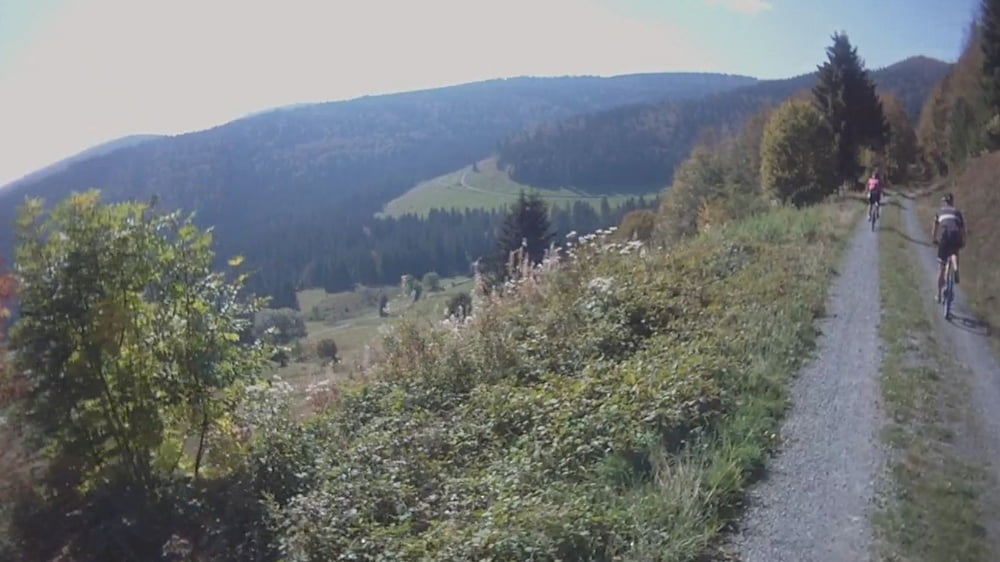
Familienfreundliche Tour, da ohne besondere Singletrails ... bis auf das Stück am Hochkopf, aber hier kann man auch den offiziellen Weg fahren zum Aussichtsturm.

Phantastische Aussicht!

Galerija izletov

Zemljevid in višinski profil izleta

  • Open Street Map
  • Google
Minimum height 875 m Maximum height 1258 m Prikaz podrobnosti

More about the tour author

kiri
Member since 2011

Send private message

Komentarji

Mit Auto nach Bernau im Schwarzwald, vor dem Rathaus parken und losfahren!

Den besten Kuchen gibt es dann auch gleich gegenüber vom Rathaus!

Poti GPS

Trackpoints
  • GPX / Garmin Map Source (gpx) download
  • TCX / Garmin Training Center® (tcx) download
  • CRS / Garmin Training Center® (crs) download
  • Google Earth (kml) download
  • G7ToWin (g7t) download
  • TTQV (trk) download
  • Overlay (ovl) download
  • Fugawi (txt) download
  • Kompass (DAV) Track (tk) download
  • List z izleti (pdf) download
  • Original file of the author (gpx) download

More about the tour author

kiri
Member since 2011

Send private message
Share track
Add to my favorites
Remove from my favorites
Edit tags
My score
Rate
Izlet: Bernau/Schwarzwald Hochkopf Tour (Video) mit phantastischer Aussicht
Vrsta: Gorsko kolo
Dolžina: 22,9 km
Evaluated on:
Trajanje:
Day(s)
Hour(s)
Minute(s)
Ocena: Pokrajina Dejavnik zabave Kondicija Tehnika