
 nicht verfehlbarer Weg")

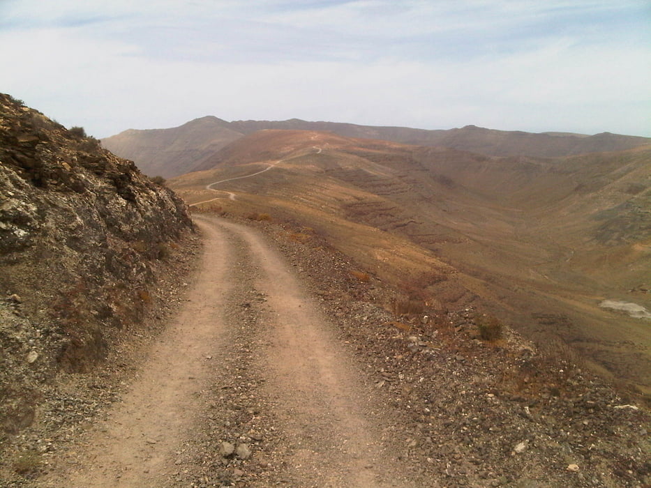
Die Gegend um Costa Calma ist nicht gerade das optimale MTB Revier. Die Wege sind teilweise sehr versandet und damit oft auf mehereren hundert Metern unfahrbar. Die Tour nach Morro Jable geht soweit wie möglich auf fahrbaren Pisten und möglichst nicht auf der Straße (1).
Es geht vorbei an den Surferstränden von Sotavento, halbfertigen Hotelbauten und Uferpromenaden, die scheinbar einsam und "ohne Grund" an der Küste liegen.
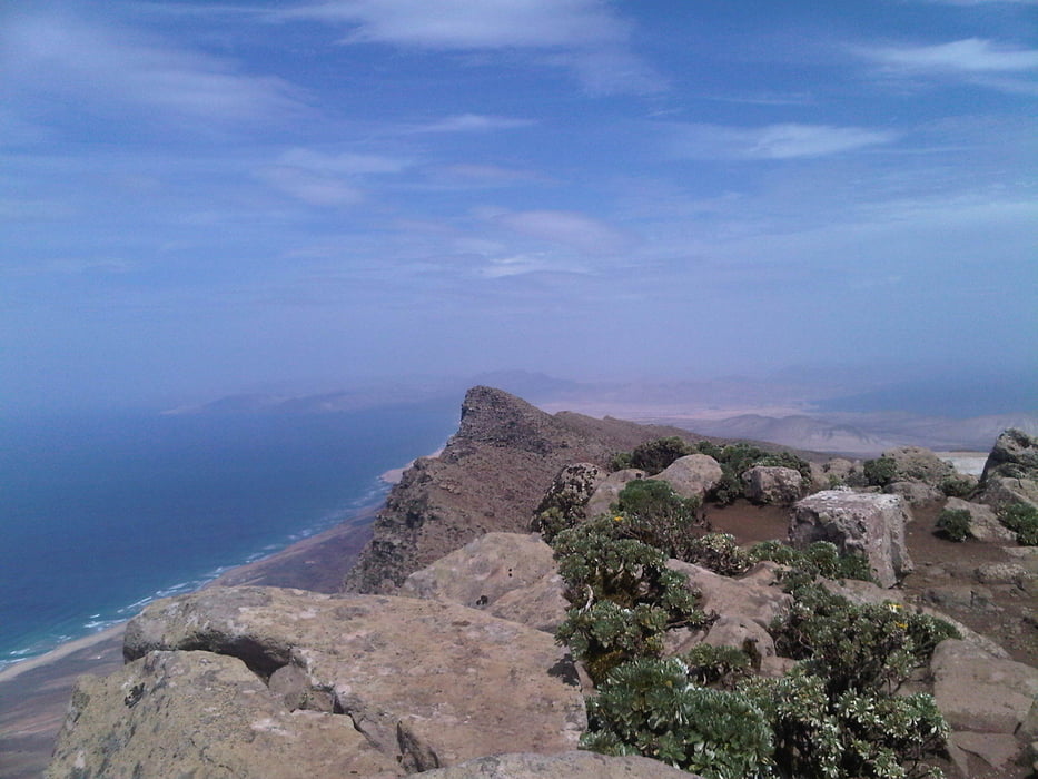
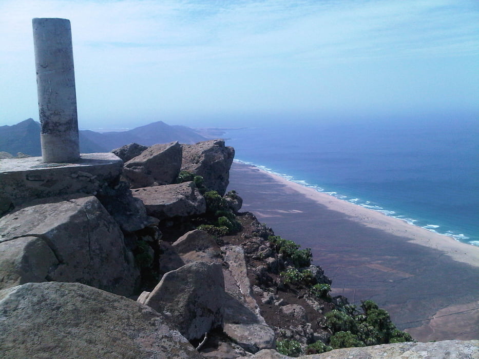
Der Aufstieg auf den Pico de la Zarza ist recht einfach zu fahren. Geringe Steigung und relativ fester Untergrund. Lediglich auf die letzten ca. 50 Hm muss geschoben werden. Die Aussicht ist aber grandios: Rundumblick auf die gesamte Insel, soweit das Auge reicht und das Wetter es zulässt.
Auf der Rückfahrt geht es dann -kurz vor Costa Calma- noch einmal auf zwei kleine Hügel, von denen schöne sandige Abfahrten abgehen...einfach laufen lassen.
Galerija izletov
Zemljevid in višinski profil izleta
Minimum height 2 m
Maximum height 811 m
More about the tour author

|
candido |
Komentarji

Poti GPS
Trackpoints-
GPX / Garmin Map Source (gpx) download
-
TCX / Garmin Training Center® (tcx) download
-
CRS / Garmin Training Center® (crs) download
-
Google Earth (kml) download
-
G7ToWin (g7t) download
-
TTQV (trk) download
-
Overlay (ovl) download
-
Fugawi (txt) download
-
Kompass (DAV) Track (tk) download
-
List z izleti (pdf) download
-
Original file of the author (gpx) download
More about the tour author
|
|
candido |
Add to my favorites
Remove from my favorites
Edit tags
Open track
My score
Rate