


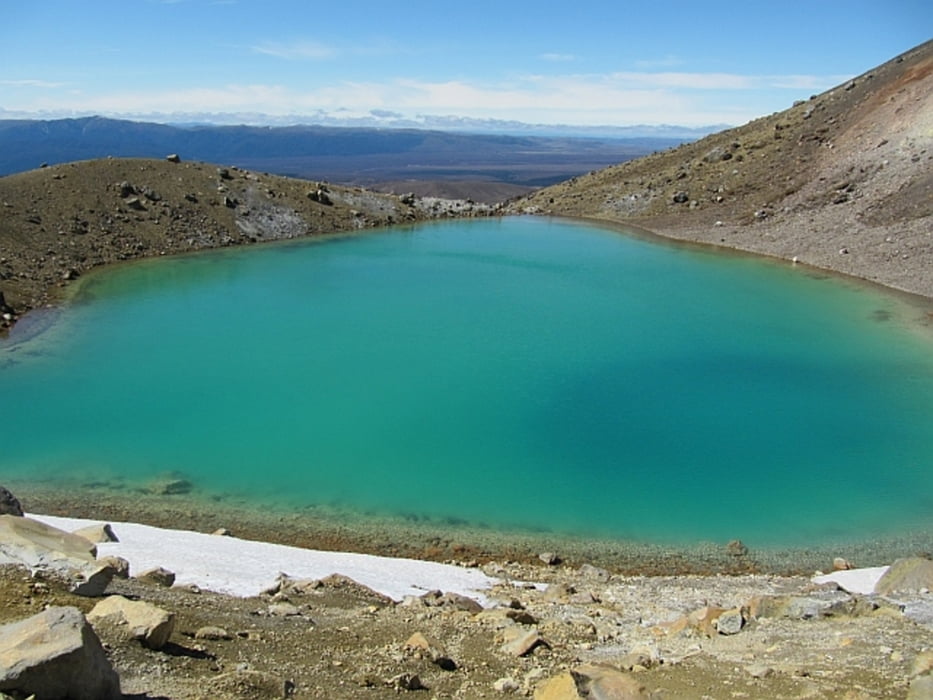
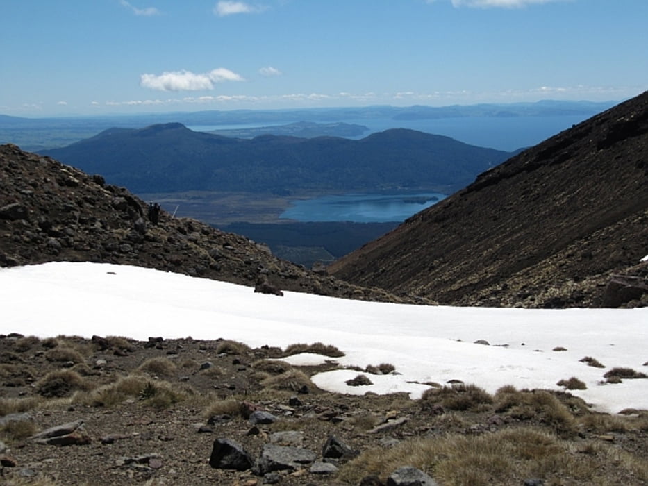
landschaftlich einzigartige Tour durch den Tongariro Nationalpark - Start beim Mangatepopo Car Park (bis hierher mit Shuttle Bus ab Turangi), vorbildlich angelegte und gesicherte Wege, z.T. Holzkonstruktion, bis Saddle unter Ngauruhoe, dann z.T. weicher/schlammiger Untergrund (South Crater) bis zum Anstieg auf den Red Crater (höchster Punkt: ca. 1890 m), Abstieg über lose Vulkanasche bis zu Emerald Lakes, Querung des North Crater und kurzer Anstieg bis Blue Lake, danach sehr langer stetiger Abstieg über Ketetahi Hut zu Ketetahi Road End (Abholung durch Shuttle Bus)
Further information at
http://www.tongarirocrossing.org.nz/Galerija izletov


Zemljevid in višinski profil izleta
Minimum height 749 m
Maximum height 1880 m
More about the tour author
|
|
Mago_58 |
Komentarji

Üblicherweise nimmt man einen Shuttle Bus (z.B. Tongariro Expeditions) in Anspruch, telefonische Anmeldung bis 1 Tag vor Tourbeginn ist erforderlich, die Abholung erfolgt am Hotel/Motel zur vereinbarten Uhrzeit (ab ca. 6:00 Uhr ab Turangi), die Fahrt mit dem Kleinbus bis zum Mangatepopo Car Park dauert ca. 1 h, Bezahlung und Registrierung im Bus, die Abholung am Zielpunkt der Wanderung erfolgt ebenfalls zu einer vereinbarten Uhrzeit am Ketetahi Car Park (ca. 15:00 Uhr)
Poti GPS
Trackpoints-
GPX / Garmin Map Source (gpx) download
-
TCX / Garmin Training Center® (tcx) download
-
CRS / Garmin Training Center® (crs) download
-
Google Earth (kml) download
-
G7ToWin (g7t) download
-
TTQV (trk) download
-
Overlay (ovl) download
-
Fugawi (txt) download
-
Kompass (DAV) Track (tk) download
-
List z izleti (pdf) download
-
Original file of the author (gpx) download
More about the tour author
|
|
Mago_58 |
Add to my favorites
Remove from my favorites
Edit tags
Open track
My score
Rate