Login

Si pozabil/a podatke za prijavo?

Cookies have to be accepted!
Your browser's cookie functionality is disabled. Please enable this functionality.

Not a member yet?

Register now
Login

Available for registred users only

Log in to use this feature.

Si pozabil/a podatke za prijavo?

Cookies have to be accepted!
Your browser's cookie functionality is disabled. Please enable this functionality.

Not a member yet?

Register now
Filter
Kategorije
Advanced filters
  • Dolžina (km)
  • Metri nadmorske višine
Shrani filter Reset filter

TrackRank

QRCode

Technical data

Dolžina27,6 km Metri nadmorske višine623 m Way down626 m Trajanje01:45 h:m Datum09.05.2012
Ocene Author Pokrajina Dejavnik zabave Kondicija Tehnika

Statistika

507 Pogledi Ocene 65 Prenosi Povprečje
Rate
  • List z izleti
  • Prihod
  • Prenosi
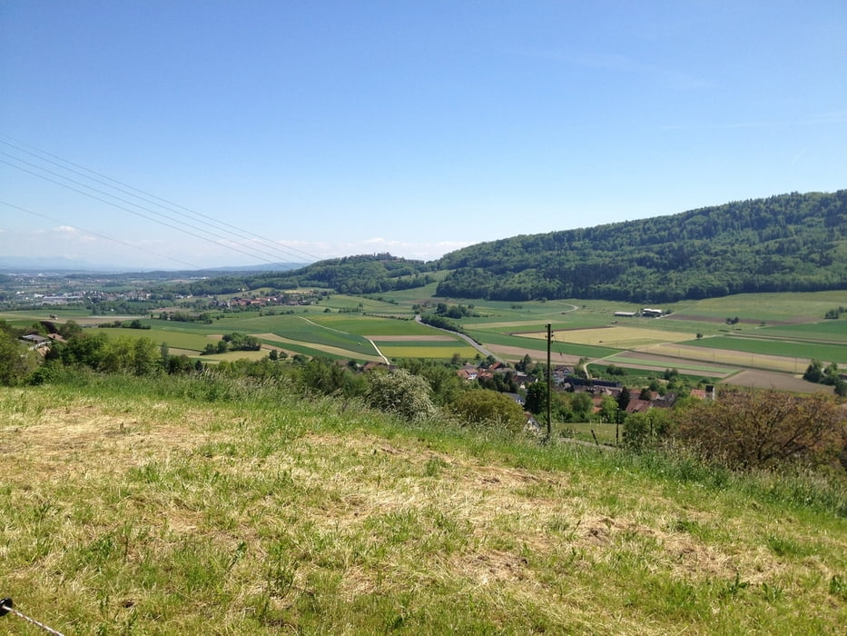
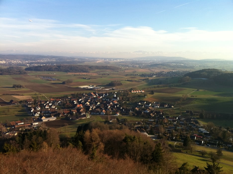
Kleine Runde in den Wäldern rund um das Wehntal mit einem Abstecher nach Regensberg, das eine schöne Rundumsicht zum Glattal mit dem Flughafen in Kloten zu bieten hat. Bei idealem Wetter kann man auch die Alpen sehen.

Galerija izletov

Zemljevid in višinski profil izleta

  • Open Street Map
  • Google
Minimum height 452 m Maximum height 721 m Prikaz podrobnosti

More about the tour author

TORROROSSO
Member since 2012

Send private message

Komentarji

Poti GPS

Trackpoints
  • GPX / Garmin Map Source (gpx) download
  • TCX / Garmin Training Center® (tcx) download
  • CRS / Garmin Training Center® (crs) download
  • Google Earth (kml) download
  • G7ToWin (g7t) download
  • TTQV (trk) download
  • Overlay (ovl) download
  • Fugawi (txt) download
  • Kompass (DAV) Track (tk) download
  • List z izleti (pdf) download
  • Original file of the author (gpx) download

More about the tour author

TORROROSSO
Member since 2012

Send private message
Share track
Add to my favorites
Remove from my favorites
Edit tags
My score
Rate
Izlet: Wehntal - Bachserwald - Lägern
Vrsta: Gorsko kolo
Dolžina: 27,6 km
Evaluated on:
Trajanje:
Day(s)
Hour(s)
Minute(s)
Ocena: Pokrajina Dejavnik zabave Kondicija Tehnika